Past Incidents
Inclement Weather Update #8: January 10, 2023
Rain and high winds to continue until the afternoon, with potential thunderstorms. Some of the storms could produce small hail and heavy rain.
January 10, 2023 Day Forecast:
High near 54. Breezy, with a southwest wind 21 to 28 mph, with gusts as high as 34 mph. Chance of precipitation is 100%. New rainfall amounts between a quarter and half of an inch possible.
January 10, 2023 Night Forecast:
Showers likely and possibly a thunderstorm before 10pm, then rain likely after 10pm. Some of the storms could produce small hail. Mostly cloudy, with a low around 47. West southwest wind 10 to 14 mph becoming south after midnight. Chance of precipitation is 70%. New precipitation amounts between a tenth and quarter of an inch, except higher amounts possible in thunderstorms.
If you are commuting, please:
- Drive with caution
- Leave early to avoid traffic
- Carry roadside emergency kit Avoid puddles, check breaks after traversing standing water
- Drive slowly on campus
- Watch out for standing water, downed trees, high winds, and park vehicles distant from possibly falling trees
- Report any damages on campus to facilities
Hazardous Weather Conditions Report: San Francisco Bay Area, CA
Inclement Weather Update #7: Flood and High Wind Warnings issued to last from January 9th-10th, 2023.
Multiple rounds of widespread rainfall expected through the next several days with a moderate strength system Saturday (Jan. 7th) through Sunday (Jan. 8th) morning, and a stronger atmospheric river event beginning Sunday (Jan. 8) evening into Tuesday (Jan. 10). Widespread flooding impacts are expected as soils are already saturated, and many waterways are running high from the recent atmospheric river events.
- Drive with caution
- Leave early to avoid traffic
- Carry roadside emergency kit Avoid puddles, check breaks after traversing standing water
- Drive slowly on campus
- Watch out for standing water, downed trees, high winds, and park vehicles distant from possibly falling trees
- Report any damages on campus to facilities
Hazardous Weather Conditions Report: San Francisco Bay Area, CA
- Flood Watch until January 10, 4:00 PM PST
- High Wind Warning until January 9, 10:00 AM PST
- Flood Advisor in effect from January 9, 7:00 AM PST until January 9, 10 AM PST
For more information, please visit: emergency.smccd.info / abc7news.com / weather.gov.
Inclement Weather Update #6:
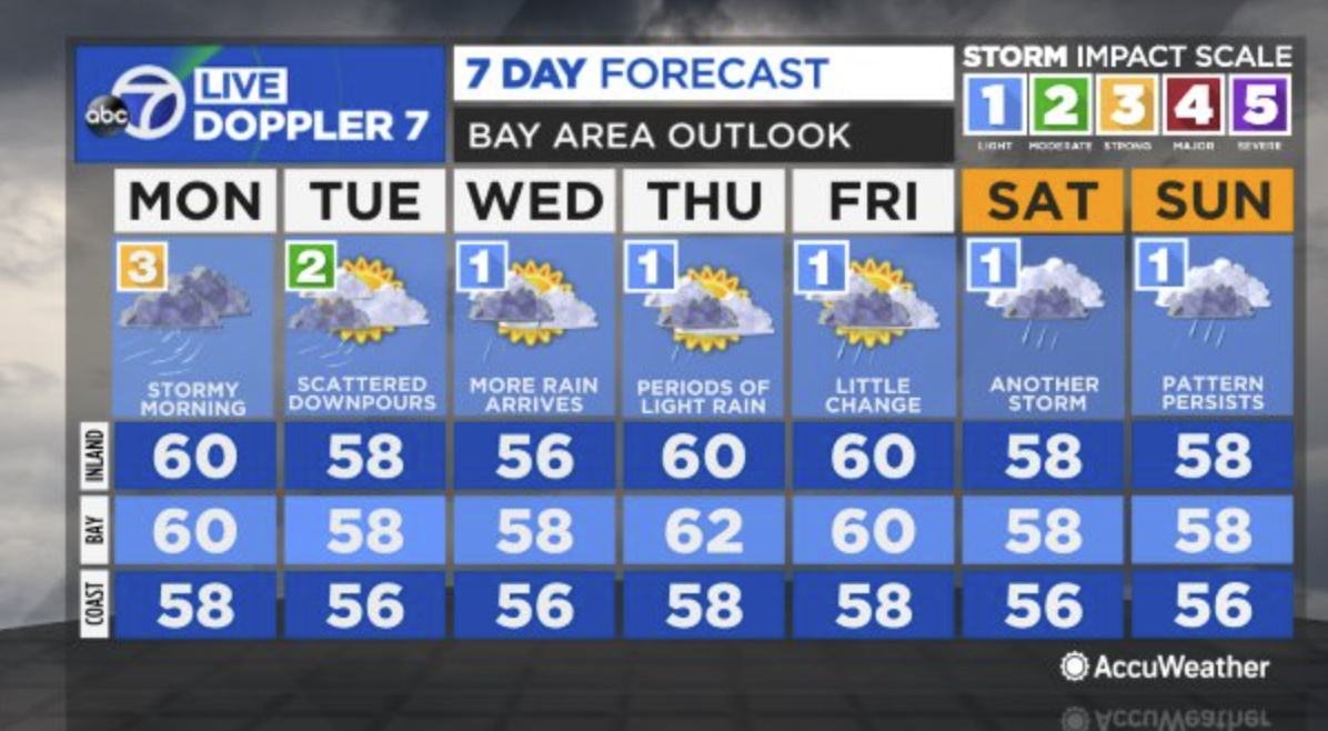
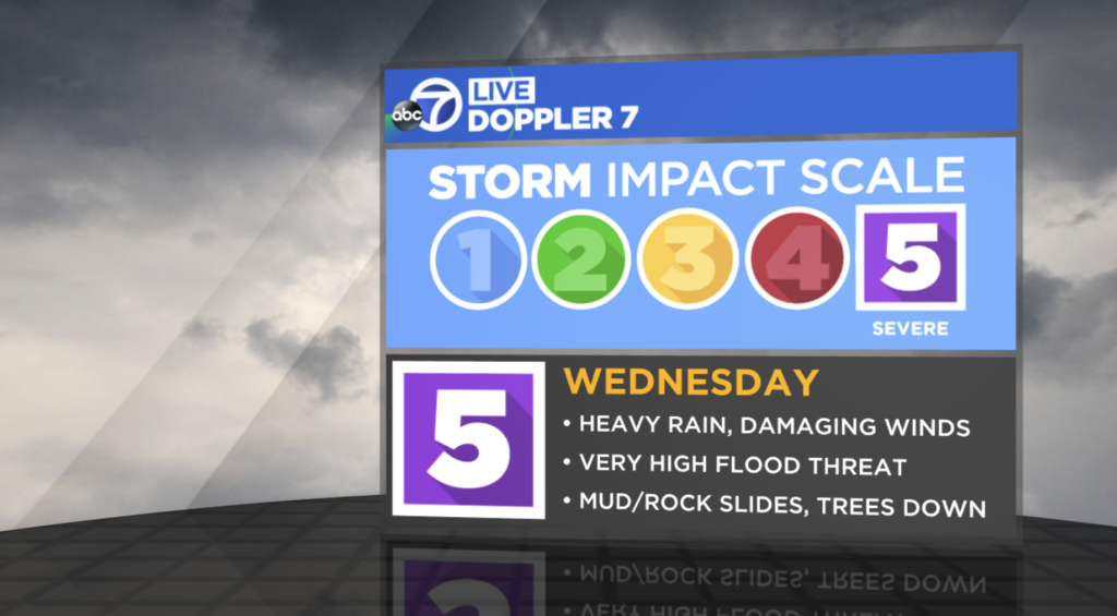
A deadly storm that lashed coastal California with hurricane-force winds and torrential rain is far from over.Thursday’s storm is ranking a strong level 3 on the exclusive ABC7 Storm Impact Scale. This is compared to the level 5 storm on Wednesday, the first level 5 in the history of the scale. San Mateo County remains under a flood warning and high winds are expected to continue. Weather forecasts expects another line of downpours between 6am – 10am today (January 5th). Please visit: emergency.smccd.info or abc7news.com for more updated weather information.
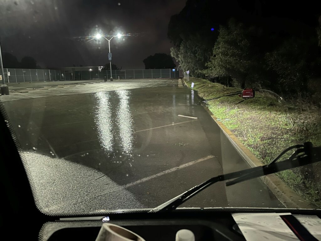
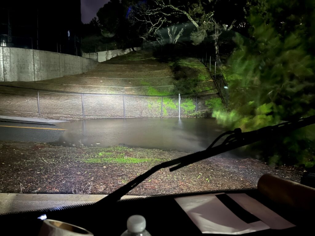
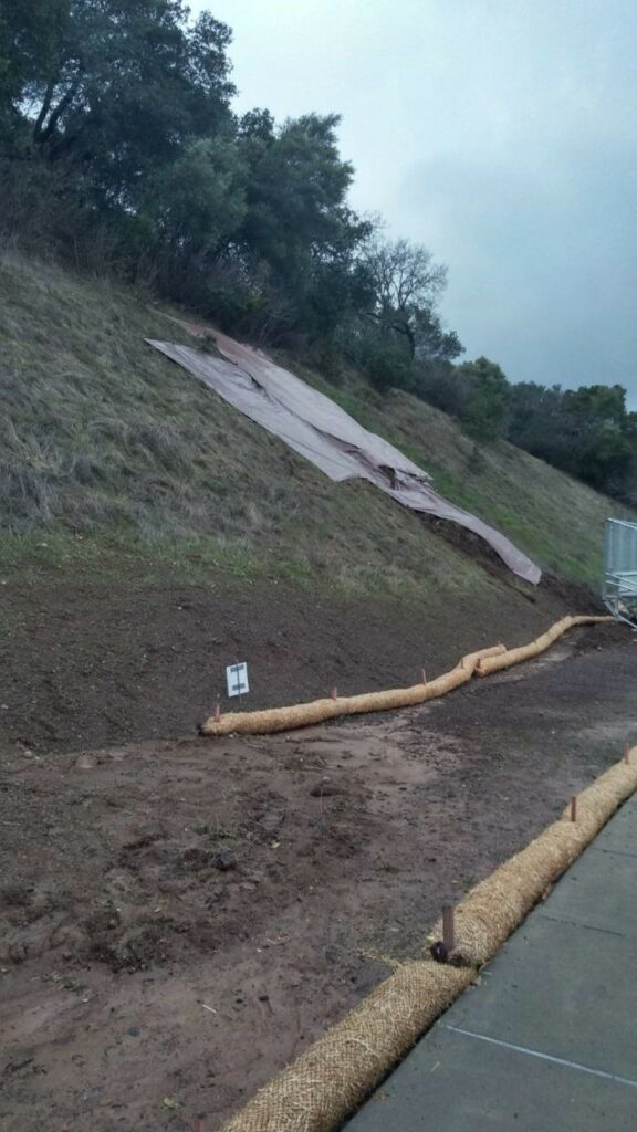
CAMPUS DAMAGE REPORTS:
The campuses fared well last night and damage is negligible. Majority of the work today is general post storm clean up—debris, mud, tree branch removals. All three campuses remained energized—no power failures.
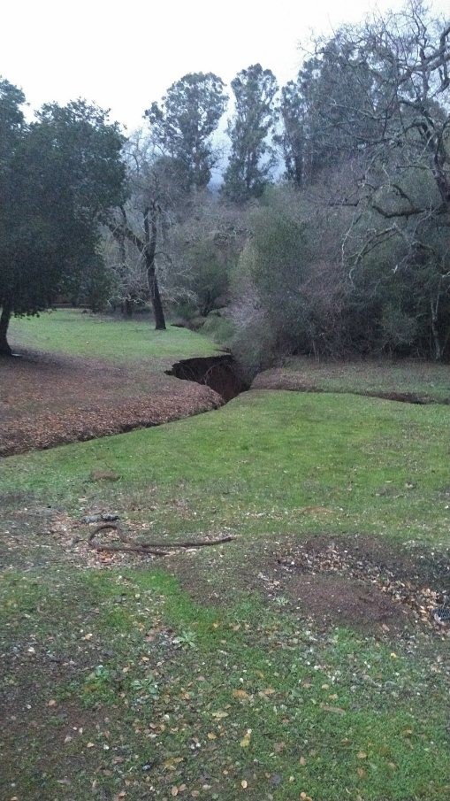
- Cañada College:
- Ravine at the West entrance: significant erosion—No impact to college or neighbors
- Mud slides near tennis courts—Mitigated by Facilities and held through the night
- B1 no additional damage or water leaks in the building
- College of San Mateo:
- Loop road at the water tank: storm drain overburdened with possible blockage—Road closed while Facilities mitigates
- Tennis court lot storm drain: backed up; parking lot D is a lake—Facilities pumping it out
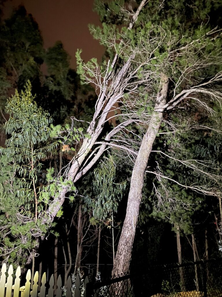
- B33 Child Development Center, East side perimeter: tree has uprooted and leaning on another tree (Hazardous)—Facilities will contact a to remove this
- B36 Planetarium: minor water intrusion—Mitigated by Facilities
- Skyline College:
- Minor water intrusion buildings 1, 3, 8, and 19—mitigated by Facilities
More updates to follow throughout the day.
Inclement Weather Update #5: SMCCCD will Remain CLOSED, January 5th.
San Mateo County Community College District’s campuses and facilities will remain closed through Thursday, January 5, 2023 due to intense storm front.
Essential service employees (facilities, public safety, ITS, and emergency management) are still required to work onsite in order to maintain essential operations. All other employees scheduled to work onsite tomorrow, Thursday, January 5, will continue to work remote. All meetings and appointments should be converted to virtual meetings if possible and appropriate. If you have questions about your work assignment, please contact your supervisor.
This closure includes the following locations and services:
- Cañada College
- College of San Mateo
- Skyline College
- SMCCCD District Office
- Sparkpoint Food Pantries at all campuses
- CSM Athletic Center and its pools
- Cañada Athletic Center and its pools
- All Athletic Events
- All community recreational use such as walking or biking
The District will announce any further closures by 6:00 pm each day about the following work day’s closures via the following:
- SMCCCD Emergency Website
- Emails/texts to all students and employee
- College websites
We encourage all to follow county guidelines by staying off the road and follow these weather safety tips:
Inclement Weather Update #4: California Gov. Gavin Newsom has issued a statewide emergency declaration Wednesday.
(Taken From CNN)
https://www.cnn.com/2023/01/04/weather/severe-storm-tornado-threat-south-wednesday/index.html
California Gov. Gavin Newsom issued a statewide emergency declaration Wednesday, clearing the way to quickly disseminate aid for those affected by the winter storms wreaking havoc on the drought-plagued state, said Nancy Ward, state director of emergency services, during a news conference.
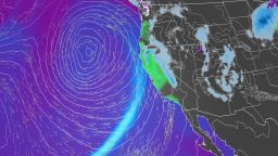
California’s latest dangerous storm is the result of a strong “atmospheric river” – a long, narrow region in the atmosphere that can carry moisture thousands of miles. Northern California and the Bay Area will see the worst impacts through the day Wednesday and Thursday as heavy rain and hurricane-force wind gusts move onshore.
The storm became a bomb cyclone Wednesday, after it rapidly strengthened while still offshore. A bomb cyclone is an area of low pressure that intensifies by 24 millibars within 24 hours. Millibars are a unit used to measure atmospheric pressure.
Along with very heavy rainfall, winds gusting as high as 60 to 80 mph will be possible.
“If these winds do materialize, the threat for scattered to widespread power outages and property damage will greatly increase,” the weather service office in San Francisco warned.
“A plethora of hazards are forecast, with heavy rain and strong winds expected to be the most widespread impact. Widespread rainfall amounts of 3 to 6 inches are anticipated, with locally higher amounts throughout the coastal ranges and over northern California,” the weather service said.
While those expected rainfall amounts wouldn’t normally have major impacts, the state recently saw heavy rain that left soil saturated and susceptible to flooding and landslides, the weather service said.
Northern California in particular was inundated with heavy snowfall and deadly flooding over the weekend, prompting evacuation orders and water rescues. That raised questions over how much the precipitation would put a dent in California’s ongoing drought conditions.
The first snow survey of the season in the Sierra Nevada Mountains released Tuesday shows the current snowpack is well ahead of average for this time of year, according to a release from the California Department of Water Resources.
California braces for more ‘brutal’ flooding and mudslides as experts warn it won’t quench historic drought
The Sierra snowpack makes up about 30% of California’s water needs on average, according to the department.
The snow depth measured Tuesday at Phillips Station, just south of Lake Tahoe, was 55.5 inches. Statewide, the snowpack is at 174% of average for this date, the agency said.
However, experts caution that despite the deluge – and expected precipitation over the coming week – the drought isn’t over yet.
“The significant Sierra snowpack is good news but unfortunately these same storms are bringing flooding to parts of California,” Department of Water Resources Director Karla Nemeth said in a news release.
“This is a prime example of the threat of extreme flooding during a prolonged drought as California experiences more swings between wet and dry periods brought on by our changing climate.”
Because of the yearslong drought, the ground can only absorb so much water and in many areas has already reached its saturation point from storms in late December and over New Year’s weekend. As a result, the influx of water is running off, leading to major flooding in places.
“This is an extreme weather event and we’re moving from extreme drought to extreme floods. What that means is a lot of our trees are stressed after three years of intensive drought,” Nemeth said. “The ground is saturated, and there is a significant chance of downed trees that will create significant problems – potentially flooding problems, potentially power problems.”
The concerns are especially high in areas recently charred by wildfire, where residents are being warned to prepare for possible evacuations.
“We’re also monitoring very closely burn scar areas,” said Nemeth. “If you are in an area that has burned recently, again, we urge you to stay connected with county (Office of Emergency Services). These kinds of events can trigger mudslides and significant debris flow. So be ready to evacuate as needed.”
And the stormy weather isn’t going to let up anytime soon. More rain is expected through the weekend, though the specific impacts aren’t clear yet.
“The message to convey is resiliency as this is not a ‘one and done’ storm,” the weather service in San Francisco said.
Inclement Weather Update #3: SMCCD will be Closed, January 4th, due to Approaching Storm Front
January 3, 2023
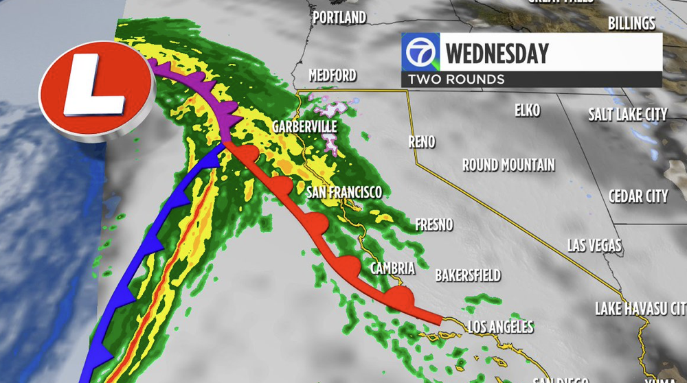
Wednesday’s incoming strong atmospheric river is the first Level 5 in the history of the ABC7 Storm Impact Scale. The National Weather Service (NWS) is saying this system will cause widespread flooding and damage. The District is implementing preventative safety measures to keep employees off the roadways and minimize impacts on county emergency services.
Access to the San Mateo County Community College District’s physical locations will close at 12:00 am midnight, except for essential employees required to maintain essential operations. This closure will be reevaluated at 5:00 pm on Wednesday, January 4th and a decision on future closures will be communicated by 6:00 pm on Wednesday, January 4th.
This closure includes the following locations and services:
- Cañada College
- College of San Mateo
- Skyline College
- SMCCCD District Office
- Second Harvest Food Distribution at Skyline College
- Sparkpoint Food Pantries at all campuses
- CSM Athletic Center and its pools
- Cañada Athletic Center and its pools
- All Athletic Events
- All community recreational use such as walking or biking
Essential service employees (including facilities, public safety, ITS, and emergency management) will report to work as scheduled. For all other employees scheduled to work on campus tomorrow, Wednesday, January 4th will be a remote work day. All meetings and appointments should be converted to virtual meetings if possible and appropriate. If you have questions about your work assignment, please contact your supervisor.
The District will announce any further closures by 6:00 pm each day about the following day’s closures via the following:
- SMCCCD Emergency Website
- Emails/texts to all students and employee
- College websites
_________________________________________________________________________________________
Inclement Weather Update #2: Level 5 Storm Impact Scale
Wednesday’s incoming strong atmospheric river is the first Level 5 in the history of the ABC7 Storm Impact Scale. The NWS is saying this system will cause widespread flooding and damage. Expect two rounds of the Level 5 storm beginning tomorrow, Wednesday, January 4. Please see details below:
First Round: Warm Front
- Expected Arrival Time: Between 5am – 10am
- Expected Damages: Areas of moderate/heavy rain expected
Second Round: Cold Front
- Expected Arrival Time: Between 2pm – 9pm
- Expected Damages: Highest flood threat & damaging wind gusts of 50mph – 60mph+
ADDITIONAL DETAILS…
http://www.weather.gov/safety/flood
Instructions: You should monitor later forecasts and be alert for possible Flood Warnings. Those living in areas prone to flooding should be prepared to act should flooding develop.
Inclement Weather Warning
EVENT: San Mateo County Standby Shelter Deployment at the College of San Mateo County Community College District
The College of San Mateo will be standing up an overflow shelter for those impacted by local storms. The primary San Mateo County Shelter Location will be at the Vagabond Inn:
Primary Shelter Location
San Mateo County will update and provide contact information.
Overflow Shelter Location
College of San Mateo
WHAT: A temporary shelter will be created in the gyms at the College of San Mateo for those who have to evacuate from their homes due to the inclement weather.
WHERE: Building 8, in the main gym, with evacuees utilizing the restrooms and showers. Parking lot utilized will be LOT C. Follow County signage.
WHEN: The shelter will be set up Tuesday January 3rd 2023-January 7th 2023
IMPACTS: If the SMCCCD gyms are utilized for shelter evacuees, impacts to District instruction and business will remain minimal, as the Semester is in waiting.
Event: High Wind Watch
HIGH WIND WATCH IN EFFECT FROM LATE TUESDAY NIGHT THROUGH THURSDAY MORNING…
WHAT…Southerly winds 15 to 25 mph with gusts up to 50 mph possible in valley locations. 30 to 40 mph with gusts up to 60 mph possible for mountain areas. Local gusts to around 70 mph possible.
WHERE…Entire Bay Area and Monterey Bay Regions. Including Sonoma, Napa, Marin, Contra Costa, Alameda, San Francisco, Santa Clara, Santa Cruz, San Benito, and Monterey Counties.
WHEN…From late Tuesday night through Thursday morning.
IMPACTS…Damaging winds could blow down trees and power lines. Widespread power outages are possible. Falling trees cause a significant threat to life and property. Travel could be difficult, especially for high-profile vehicles.
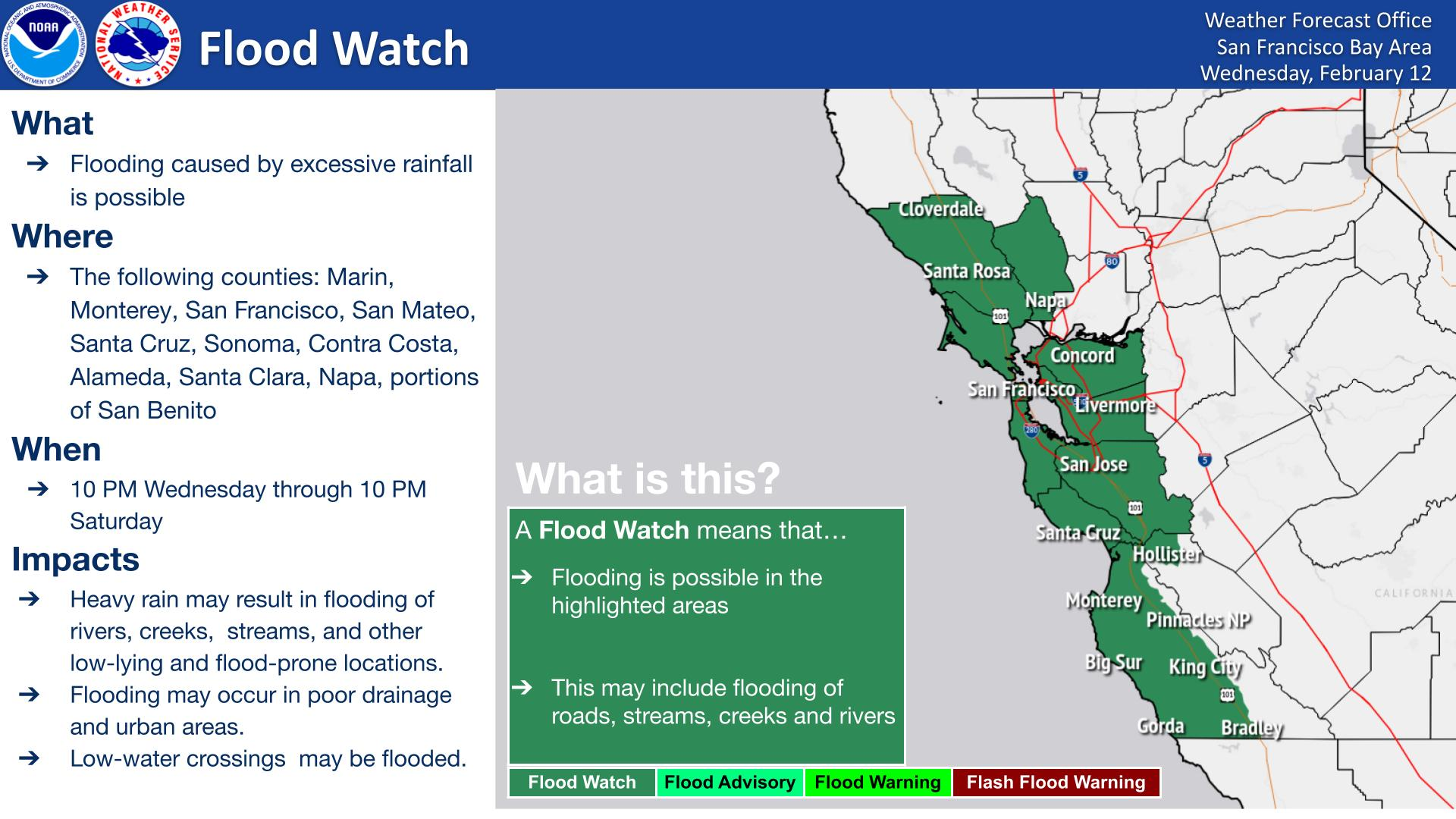
Event: Flood Watch
A potent storm will move into the region Wednesday and continue into Thursday. This will bring substantial rainfall to the Bay Area and Monterey Bay region on top of already saturated soils. As a result, look for rapid rises in area creeks, streams, and rivers. Bank full exceedance is possible. In addition, strong gusty winds will bring branches and trees down, which may cause localized damming of water ways. Rain will taper by Thursday afternoon, allowing for rivers to level off and begin to lower.
…FLOOD WATCH IN EFFECT FROM LATE TUESDAY NIGHT THROUGH THURSDAY AFTERNOON…
WHAT…Flooding caused by excessive rainfall is possible.
WHERE…Bay Area and Monterey Bay Regions. Including Sonoma, Napa, Marin, Contra Costa, Alameda, San Francisco, San Mateo, Santa Clara, Santa Cruz, San Benito, and Monterey Counties.
WHEN…From late Tuesday night through Thursday afternoon.
IMPACTS…Excessive runoff may result in flooding of rivers, creeks, streams, and other low-lying and flood-prone locations.
Creeks and streams may rise out of their banks. Flooding may occur in poor drainage and urban areas. Low-water crossings may be flooded. Storm drains and ditches may become clogged with debris.
Extensive street flooding and flooding of creeks and rivers are possible.
ADDITIONAL DETAILS…
http://www.weather.gov/safety/flood
Instructions: You should monitor later forecasts and be alert for possible Flood Warnings. Those living in areas prone to flooding should be prepared to act should flooding develop.
Target Area
- Coastal North Bay Including Point Reyes National Seashore
- East Bay Hills
- East Bay Interior Valleys
- Eastern Santa Clara Hills
- Mountains Of San Benito County And Interior Monterey County Including Pinnacles National Monument
- North Bay Interior Mountains
- North Bay Interior Valleys
- Northern Monterey Bay
- Northern Salinas Valley, Hollister Valley and Carmel Valley
- San Francisco Bay Shoreline
- San Fransisco Peninsula Coast
- Santa Clara Valley Including San Jose
- Santa Cruz Mountains
- Santa Lucia Mountains and Los Padres National Forest
- Sonoma Coastal Range
- Southern Monterey Bay and Big Sur Coast
- Southern Salinas Valley, Arroyo Seco and Lake San Antonio
Excessive Heat Warning Issued for Bay Area for Labor Day Weekend
An excessive heat warning was issued Wednesday morning by the National Weather Service as an area of high pressure settled over the western United States. The excessive heat warning is the highest alert issued by the NWS, and was upgraded from an excessive heat watch issued on Monday. (Whiting, 2022)
The California grid operator is asking Californians to reduce their electricity use between 4 and 9pm on Thursday through Tuesday to ease the strain on the power grid caused by high temperatures and air conditioning use — for example by setting the thermostat to 78 degrees or higher (and 85 degrees for those who are not at home). Another energy-saving request has already been issued for Thursday between 4 and 9pm, and more such requests, known as Flex Alerts, are likely during the Labor Day weekend as the worst of the heat wave hits.
Meteorologists predict all-time daily records on Saturday in Gilroy at 107, and Sunday in Livermore where it may approach or top the 113 degree set in 1950. Regionally, all areas were expected to record temperatures between 10 and 25 degrees above the daily average for Sunday and Monday.
What can you do?
- Avoid being outdoor during the late morning and afternoon
- Stay hydrated in a cool place
- Use air conditioning if available
- Use shade, sunblock, and misters
Take measures to stay cool, stay hydrated, and stay informed. Getting too hot can make you sick. You can become ill from the heat if your body can’t compensate for it and properly cool you off. The main things affecting your body’s ability to cool itself during extremely hot weather are:
- High humidity. When the humidity is high, sweat won’t evaporate as quickly. This keeps your body from releasing heat as fast as it may need to.
- Personal factors. Age, obesity, fever, dehydration, heart disease, mental illness, poor circulation, sunburn, and prescription drug and alcohol use all can play a role in whether a person can cool off enough in very hot weather.

People aged 65 and older are at high risk for heat-related illnesses.
Those who are at highest risk include people 65 and older, children younger than two, and people with chronic diseases or mental illness.
Closely monitor people who depend on you for their care and ask these questions:
- Are they drinking enough water?
- Do they have access to air conditioning?
- Do they need help keeping cool?
People at greatest risk for heat-related illness can take the following protective actions to prevent illness or death:
- Stay in air-conditioned buildings as much as you can. Air-conditioning is the number one way to protect yourself against heat-related illness and death. If your home is not air-conditioned, reduce your risk for heat-related illness by spending time in public facilities that are air-conditioned and using air conditioning in vehicles. Contact your local health department or locate an air-conditioned shelter in your area.
- Do not rely on a fan as your main cooling device during an extreme heat event.
- Drink more water than usual and don’t wait until you’re thirsty to drink.
- Check on a friend or neighbor and have someone do the same for you.
- Limit use of the stove and oven—it will make you and your house hotter.
Even young and healthy people can get sick from the heat if they participate in strenuous physical activities during hot weather:
- Limit your outdoor activity, especially midday when the sun is hottest.
- Pace your activity. Start activities slowly and pick up the pace gradually.
- Drink more water than usual and don’t wait until you’re thirsty to drink more. Muscle cramping may be an early sign of heat-related illness.
- Wear loose, lightweight, light-colored clothing.
If you play a sport that practices during hot weather, protect yourself and look out for your teammates:
- Schedule workouts and practices earlier or later in the day when the temperature is cooler.
- Monitor a teammate’s condition and have someone do the same for you.
- Seek medical care right away if you or a teammate has symptoms of heat-related illness.
- Learn more about how to protect young athletes from heat-related illness by taking this CDC course.
Everyone should take these steps to prevent heat-related illnesses, injuries, and death during hot weather:
- Stay in an air-conditioned indoor location as much as you can.
- Drink plenty of fluids even if you don’t feel thirsty.
- Schedule outdoor activities carefully.
- Wear loose, lightweight, light-colored clothing and sunscreen.
- Pace yourself.
- Take cool showers or baths to cool down.
- Check on a friend or neighbor and have someone do the same for you.
- Never leave children or pets in cars.
- Check the local news for health and safety updates.
***For more information: visit the CDC at https://www.cdc.gov/nceh/features/extremeheat/index.html
CSM Power Outage Update
Wednesday, June 22
Update: Power and water have been restored to the College of San Mateo. Instruction and business will resume to normal operating procedures.